Patricia Temples Photography

MAKE IT AN ADVENTURE! All rights reserved.

Archive for the category “TRAVELS”

On to Capitol Reef National Park

We arrived safely in Torrey, Utah, a quaint little town with plenty of restaurants and art galleries and shops for local products. Lunch was the first order of business and we found Cafe Diablo on the outskirts of town, which was recommended by Fodor’s. This turned out to be a wonderful restaurant and we ate there three times in the next couple of days.

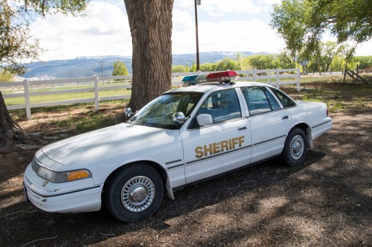
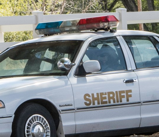
As we drove through Torrey, there were speed limit signs and digital signs telling us how fast we were going. They were serious about speeding! In addition, the sheriff’s car was parked in a prominent location in the middle of the busiest area, and so we paid close attention to the speedometer.

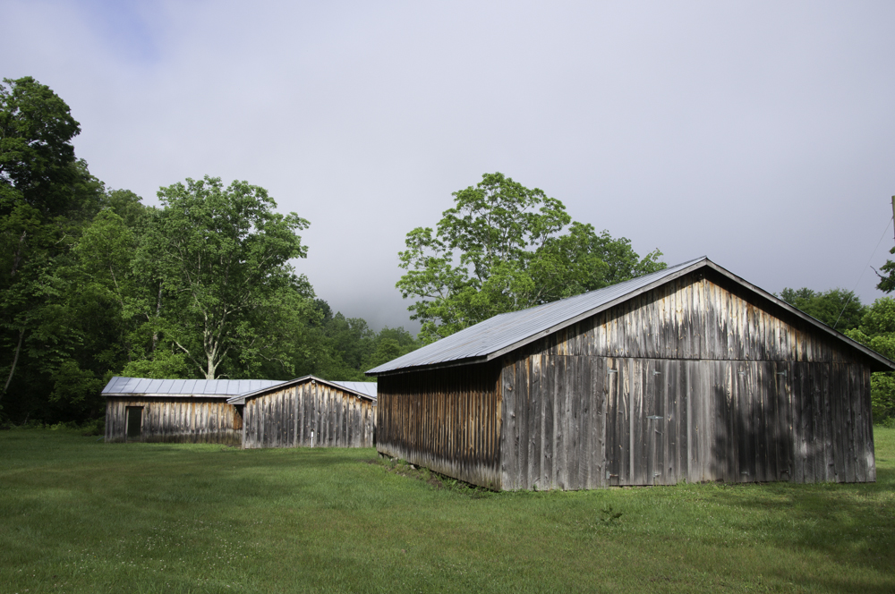
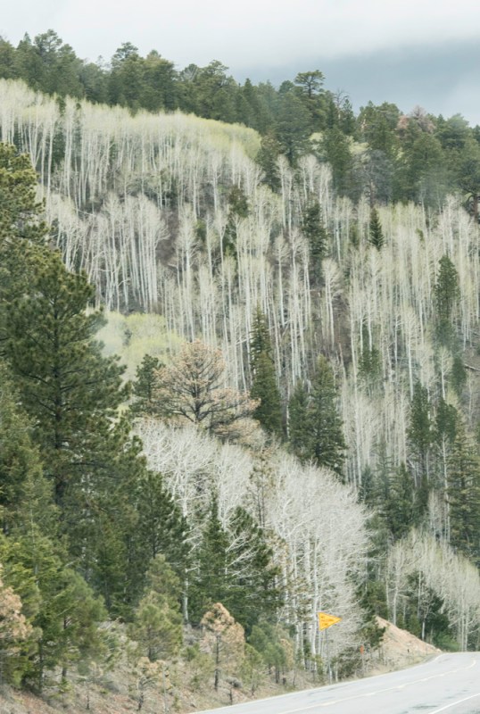
Capitol Reef National Park is a large park.  Within its borders there is an early Mormon settlement named Fruita, which has a lovely little park and gigantic aspen trees.  I can proudly say I was hugged by an aspen tree.  They also had a fenced off area where they were protecting Chinese Wisteria!!  We consider that an invasive here in Virginia, but out there, they are trying to bring back this large vine.CRNP 3

CRNP 4

We drove on paved and unpaved roads in Capitol Reef NP.  The unpaved roads got us down among the rocks, and into magical places.

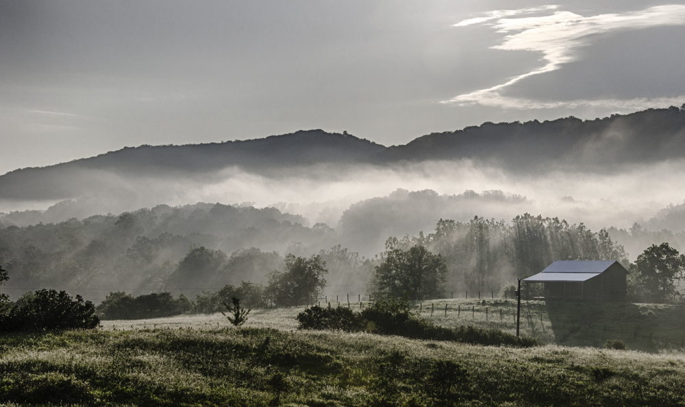
After several hours in the park, we went back into Torrey and investigated going on a Jeep Tour into an area of the park where the roads are rougher. We thought it would be great to have a guide to tell us about the landmarks there and other local information. However, that night we got a call that they had overbooked and wouldn’t be able to take us on the Jeep Tour. So, instead, the next day we drove ourselves into the Waterpocket Fold area of the park. What a great decision that was!  We would have missed that if we had gone on the Jeep Tour. This is what the Park is known for.  A giant monocline has pushed up into high cliffs, leaving a flat valley below. The monocline stretches for 100 miles. We drove through private land for a bit before hitting the park boundaries, and we saw Sandy Ranch, a huge operation below us with cows, lush green grass, and an occasional farm truck.  Then we went once again on unpaved roads, which led us back to Boulder on Route 12!!

This slideshow requires JavaScript.

We returned again to Torrey and again to Cafe Diablo.  This meant we had to go through the speed trap!  Every time we went through town, which was often, we saw the Sheriff’s car sitting there.  So, I decided to take a good look.  There was a dummy sitting in the driver’s seat!  So, on one trip through I made Roger pull off, I walked over to the car and took a couple of shots. You can imagine what the tourists were thinking who drove through while I was standing there with my camera!

Torrey Sheriff 1Torrey Sheriff 2


Utah’s Scenic Byway, Route 12

We were told by locals and tourists alike that if we were headed to Capitol Reef National Park, we needed to take Route 12, a scenic byway and All-American Road. A road receives All-American designation by having scenic views unlike any anywhere else, and there are not many roads with this designation.  So, on Monday morning we headed out from Bryce Canyon NP (lower left) to Capitol Reef (upper right center at Torrey) via Route 12.

Route 12 Map.jpg

A guest at the lodge with whom I had a conversation told me it was a spectacular road, with pullouts and special sights all along the way.  He also told me that there was a section of the road which had sheer cliffs on either side.  “I just don’t know why they didn’t put guard rails on that section,” he said.  That was enough to get me going.  I dreaded that section all the way.

The scenery was indeed spectacular and there were sufficient pullouts (that’s what they call them in the west) to give me opportunities for shooting while standing still, something I hadn’t done nearly enough of, it seemed.  I was particularly excited by the heavy cloud formations overhead.  We innocently discussed the possibility of rain on this trip over the mountains.  But, I loved the drama they created and every time I held the camera to my eye, I had a heart palpitation!  Magnificent.

This slideshow requires JavaScript.

But, I kept my eye on the map and the upcoming cliffs with sheer drops and no guard rails.

Route 12 7

It got gloomier, and it was clear we were headed into a storm.  Then, at 9300 feet on our GPS, the snow started coming down, then hail. The road quickly turned white.

Route 12 8

We drove slowly through this squall, meeting a few cars on the way, and every foot of the trip I’m thinking…..we have to drive on this slick road with no guard rails and sheer drops down the mountain.

Soon we started getting out of the snow, and things began to brighten.  We started seeing beautiful birch trees with their white trunks and black markings, just beginning to have new yellow-green leaves for the season.  I loved them.  But, I”m still worried.

Route 12 9

Route 12 10

Route 12 11
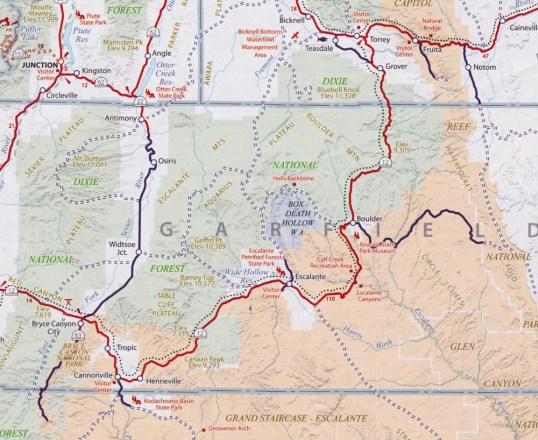
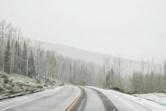
The next thing I know we’re in Boulder, Utah!  Looking at the map, I could see we had passed the dreaded section of road.  I had missed it!  I still don’t know how. I think I must have just “blacked out” when we got there, since I was quite worried about it.  My husband, the driver, says it was a bit scary.  We had hit it before the snow storm and I didn’t even know.

After writing this draft, I decided to google “The Hogback, Route 12, Utah” and found a couple of youtube videos of the drive.  I don’t think I missed it at all!  I think it just wasn’t nearly as scary as I had imagined it would be.  It’s a one-mile section between Escalante and Boulder. Try it for yourself and tell me what you think.

Zion National Park

We made the unfortunate decision to drive into Zion National Park on a Sunday. We left Bryce about 9:30am and arrived at the east entrance around 11am. Traffic was heavy. Looking at a map, we determined that many of the desirable viewpoints in the park were accessible only by the shuttle bus, so we decided to go directly to a parking area and get on a bus. The first obstacle we encountered was getting through the 1.1-mile tunnel near the east entrance. Because it was carved out of a mountain in the 1930s and is fairly narrow, a limited numbers of cars and campers are allowed to go through at a time.  That means that you must wait in a line near the entrance for a time to enter to be made available.  After that 20-30 minute wait, we were through the tunnel and on our way. But, the problem was that the traffic volume in the park was heavy and slow, and when we got to the Visitors Center, no parking was available. We kept moving, never finding parking even in the overflow lots. We never saw more than we could see from the car and a few busy pullouts along the way. We exited through the south entrance, turned around and re-entered, once again waiting to go through the tunnel on the other end and back to Bryce Canyon Lodge. One interesting tidbit.  The roads in the park are colored asphalt, the red color of the rocks in Utah. You can see that in the first photo.

ZNP 13

That said, Zion is a beautiful park.  Unlike Bryce Canyon, you are down among the cliffs.  They are close to you and you are constantly looking up at them.  We regret not being able to go on the shuttle to less accessible areas of the park, but my photos, many of them from the car, will tell you what’s there and how disappointed we were not to see more.  Enjoy.

This slideshow requires JavaScript.


Bryce Canyon National Park, Day 2

Each of Utah’s Mighty Five National Parks is unique in its own way. Bryce Canyon has a rim around which you can walk the canyon, or you can hike or go by horseback down into the canyon. We stayed at the rim on all our visits. The characteristic feature of Bryce Canyon is the Hoodoos. These formations are eroded out of the cliffs where rows of narrow walls form, called fins. With frost cracking the fins and creating windows, eventually the tops collapse and a column is left behind.  Additional impact by rain sculpts these pillars into spires called Hoodoos. Some of the Hoodoos look like people gathering to me.  In one photo you will see rows of Hoodoos, and my husband told me he thought they looked like people in church pews. Look in one of these photos for what I thought looked like an adobe village, with Hoodoos standing in a group on the right.

This slideshow requires JavaScript.

I went out for sunrise at Bryce. When I first got to the rim, I thought I was alone there. But soon I heard male voices talking, even though I never saw them. Gradually more and more people arrived, and I had conversations with several of them. There was serious cloud cover, which can sometimes make a sunrise very special. This sunrise was not spectacular, and many left soon after the light rose over the canyon. I hung on for a bit longer, but it didn’t pay any dividends. However, I loved being there at that time of day.

This slideshow requires JavaScript.

The scenic drive takes you out into the plateau where there is vegetation and a very different look. There are many short hikes along the drive to overlooks with different viewpoints of the canyon. Along that drive we saw evidence of a serious fire, which I learned had occurred last July 2015. Regeneration had begun on the floor of the forest,  but many trees were black and bare.


BCNP Day 2-12BCNP Day 2-5


Bryce Canyon is at an elevation of over 8000 feet, and on the third morning there, I began to experience “Mountain Sickness.” We had been advised early in our planning to drink plenty of water when we were at higher elevations, and we had been doing that for the four days on the road getting to Bryce. But, my symptoms persisted until we left the park and got below 6000 feet. Light-headedness, loss of appetite and nausea, and poor balance all impacted my enjoyment of the park. Fortunately, it reached its “peak” (if you’ll pardon the pun) on the last day, so I was able to enjoy the rim walks and the scenic drive before it hit.

This slideshow requires JavaScript.


Bryce Canyon National Park

I’ve just returned from a wonderful trip out west.  Our primary goal was to see The Mighty Five National Parks of Utah.  We met that goal and more. As a tribute to this year’s 100th Anniversary of the National Park Service, I will show you images from each of the Mighty Five, plus a bonus park, but they will come one blog post at a time.

Our first park stop was Bryce Canyon National Park, where we stayed in a room in the lodge on park property. At check-in, I was told that we had a second floor room with no elevators, and I groaned.  She said, “You have a really great room. All you have to do is walk outside and after a short hike you will be at the rim.”  I didn’t know what to expect, but she was right. It was a really great room. We had a balcony that looked out toward the rim and we could see people walking on the path. We left the building and started up a slight incline through the trees. Near the end of the trail, we could see two guys standing on the edge, one with a camera.

What we saw next took our breath away.  There was the canyon, practically at our back door.

BCNP 3

Everywhere we looked there were spectacular sights. This was late afternoon, and as we walked on the rim, the clouds got heavier and darker.  We never had rain, but in the distance it was apparent someone was getting it. Day Two at Bryce will include sunrise photos and once again some late afternoon shots.  Stay tuned.

This slideshow requires JavaScript.

Highland County, Part 2: Doe Hill and Bolar Springs

On my second day in Highland I covered a lot of ground. I started the day following the fog in the Bullpasture Mountain region, up Doe Hill Road and across Jack Mountain. The fog was so amazing. The ride across Jack Mountain was on a narrow, gravel road, but there weren’t many views of the valley below because of the trees. That’s a trip for another season.

As I proceeded up Doe Hill Road, I found an old cemetery and that held my attention for quite a while. The tilted headstones, the fog in the background, even the power lines were beautiful. I entered Pendleton County, West Virginia briefly, but my quest was the fog of Virginia, so I turned around.

Barn at sunrise

Driving up Doe Hill Road as the sun tried to make its way through the fog.

Barn at sunrise in fog

The sun’s rays through the fog provide a special mood to this photograph.

B&W Cemetery 2

The old cemetery on Doe Hill Road.

After I crossed Jack Mountain, we were on Route 220, so we headed south to Bolar Springs. My travel companion and guide was an old friend who has been living in Highland County for a year, growing veggies in a new greenhouse and learning the ways of the Highland County bureaucracy as he starts his new business. He told me that Henry Ford created a camp community around the natural springs in Bolar. A talk with locals earlier that morning had revealed to me that the springs have healing power. They are always at 73 degrees, and even thought the algae and undergrowth in the pool is not appealing, apparently it is good for what ails you. One of the locals said he got in the pool to take care of the itching and blistering of poison oak and it did indeed work. My travel companion soaked a wound on his foot that wouldn’t heal and three days later, he had scabs and the wound cleared right up! The camp is not used anymore, but the folks who live in Bolar keep it mowed and tidy.

Bolar Springs 1

Old buildings in Bolar

Bolar Springs 2

The spring comes in at the top of this image and fills a man-made pool, then overflows into a creek. There is a lot of water coming in from that spring.

Bolar Springs 3

This is the entry into the natural springs pool.

Post Navigation

Our Cape Escape

renovation realities

Photography Life

PL provides various digital photography news, reviews, articles, tips, tutorials and guides to photographers of all levels

Perception

Photography. Life.

cookiecrumbstoliveby

Life through the eyes of "cookie"

The Legion of Door Whores

...for those who appreciate doors...

Ray Ferrer - Emotion on Canvas

** OFFICIAL Site of Artist Ray Ferrer **

Belle Grove Plantation Bed and Breakfast

Birthplace of James Madison and Southern Plantation

Leaf And Twig

Where observation and imagination meet nature in poetry.

Photography Improvement

Site Transferred from WordPress.com

Firnew Farm Artist's Circle

We meet weekly, and host: Review & Critique of New Works. Our Annual Spring Show is in May and our Annual Fall Show is September - October. Contact: Trish Crowe 540 948 3079

John Berry Photography

Portrait, Sports, Landscape Photographer in Central Virginia

CJ's Workshops

FILM INSPIRES!