Patricia Temples Photography

MAKE IT AN ADVENTURE! All rights reserved.

Archive for the category “National Parks”

Mesa Verde National Park, Colorado

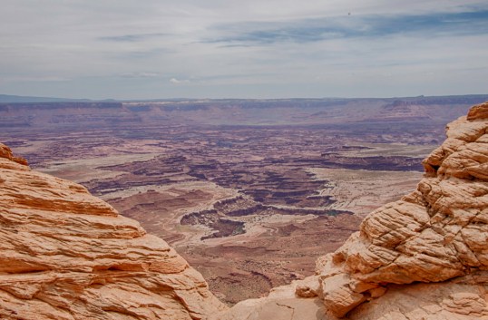
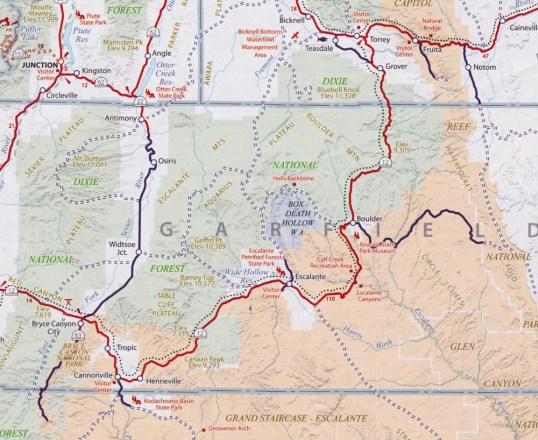
We left the Mighty Five Parks in Utah, heading out for our return trip to Virginia. We took the southern route back, and there were several things we wanted to see along the way.  But, at the beginning of our trip, soon after we entered Colorado, we noticed another National Park not far from our route. So, we stopped in the town of Cortez to inquire at the Visitors Center about Mesa Verde. On the map, it is a relatively small park, especially compared to the huge Canyonlands Park we had just left. When I said that to the volunteer, she raised her eyebrows at me and said, “Well, to see even the best part of the park will take you four hours.”  Wow. She was right. We spent just about that much time in this park and could have spent more.

Mancos ValleyBecause this is such a fascinating park, I am going to give you more facts, all lifted from the official brochure you receive at the visitors center.

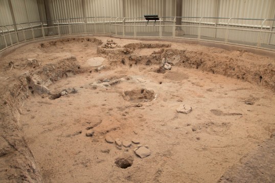
Mesa Verde is Spanish for “Green Table.”  Ancestral Pueblo people settled in this area in A.D. 500.  They farmed, hunted wild animals and gathered edible plants.  They also made tools from stone, wood, and bone, and built pit houses for homes.  Pit houses were often clustered as small villages on the mesa tops. In the second photo below, you can see that they designed a system to keep their fires burning inside the pit.  Placing a stone in front of the opening below created a draft to pull air through and out a hole on the surface above.

Pithouses 1

Pithouses 2

In about A.D. 750, the Pueblos began building houses above ground using poles and mud.  By A.D. 1000 their skills had advanced to stone masonry.  Walls of thick stone often rose two to three stories high and were joined as units of 50 rooms or more.  Some of these homes were built in cliff alcoves that had once served their ancestors as sheltered areas.  The cliff dwellings are what made Mesa Verde famous.

Cliffdwellings 5A

Cliffdwellings 5B

Cliffdwellings 5

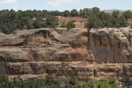
Most of the cliff dwellings were built from the late 1190s to late 1270s.  They range from one-room houses to community centers of about 150 rooms.  Builders fit the structure into the available space.  Notice the gorgeous stone around the cliff dwellings.  It’s a part of the beauty of the space, much as our land accentuates our property.

This slideshow requires JavaScript.

As we looked with binoculars across the canyon to the cliffs, we wondered how the Pueblos moved from one house to another, or from their home on the cliff to their gardens above.  It was a hard life.  They lived in the cliff dwellings for fewer than 100 years, and by 1300 Mesa Verde was deserted.  They joined other Ancestral Pueblo who moved south into what is now New Mexico and Arizona.

Local ranchers first reported the cliff dwellings in the 1880s.  Archaeologists have studied, excavated, analyzed and restored pit houses and cliff dwellings.  The history reveals people adept at building, and skillful at making a living on difficult land.   The evolution of their skills is evident in the various structures seen in the park.

Cliffdweller statue


Arches National Park

I’ve saved this Utah Park for last, even though it wasn’t the last of the Mighty Five we visited, but because this is a Park that many people know and recognize. We wisely determined that we should go to this park on Thursday instead of Friday after our experience at Zion. We entered this park at 7:30am, which was really too late for a sunrise photographer, but the light was still great, and the crowds were still asleep. It was a beautiful time to be there. My images don’t have the wow you have seen from other photographers, but I’m happy with them nevertheless.

ANP !ANP 2ANP 3

ANP 4

Petrified dunes

ANP 5ANP 6ANP 7-2ANP 8ANP 9ANP 10ANP 11

Canyonlands National Park

Canyonlands National Park is Utah’s largest park.  It is divided into four districts, but we only saw one, Island in the Sky.  That is the northernmost section, and it is a broad mesa bordered by the Green River on the west and the Colorado River on the east.  These two photos are from the Green River Overlook.

CLNP 1CLNP 2

There is a White Rim in the canyons below the overlooks, which is sandstone. A ranger talk that we heard indicated that when this area was under water, sand was deposited along the rim and as the water receded, essentially a beach was left behind.  If you look closely in the photo below, you can see a car approaching the whitest area in the foreground.  Special permits allow cars to go into the canyon for exploration or camping.  The day before we were going into the park, a shopowner showed us a special weather alert.  The White Rim Road was going to be closed the next day because of the expectation of 3 feet of water in the area!  We watched the weather forecast that night, but no rain was predicted.  I inquired of a hiker whom I heard talking at breakfast.  He was going into that area, and the water expectation was because of snow melt in the mountains.  It was going to be 84 degrees that day.  As you can see, the car was traveling in a totally dry area.  Some bikers also went by on this path near the rim as I watched.

CLNP 5

We heard a wonderful ranger talk about the geology of the park. It’s easy to see why this is called Canyonlands.

CLNP 10


Ranger 1Ranger 2

I walked out to Mesa Arch, which gives you a wonderful framed view of the La Sal Mountains in the distance.  I also saw a variety of desert plants on the short hike to this arch.  The arch was busy with photographers, both amateur and professional. As we jockeyed for position, one woman fell head first down a short, but steep cliff not far away.  I think she had a few bruises, mostly to her ego.  That could have been me in a heartbeat.

CLNP 13

On to Capitol Reef National Park

We arrived safely in Torrey, Utah, a quaint little town with plenty of restaurants and art galleries and shops for local products. Lunch was the first order of business and we found Cafe Diablo on the outskirts of town, which was recommended by Fodor’s. This turned out to be a wonderful restaurant and we ate there three times in the next couple of days.

As we drove through Torrey, there were speed limit signs and digital signs telling us how fast we were going. They were serious about speeding! In addition, the sheriff’s car was parked in a prominent location in the middle of the busiest area, and so we paid close attention to the speedometer.

Capitol Reef National Park is a large park.  Within its borders there is an early Mormon settlement named Fruita, which has a lovely little park and gigantic aspen trees.  I can proudly say I was hugged by an aspen tree.  They also had a fenced off area where they were protecting Chinese Wisteria!!  We consider that an invasive here in Virginia, but out there, they are trying to bring back this large vine.CRNP 3

CRNP 4

We drove on paved and unpaved roads in Capitol Reef NP.  The unpaved roads got us down among the rocks, and into magical places.

After several hours in the park, we went back into Torrey and investigated going on a Jeep Tour into an area of the park where the roads are rougher. We thought it would be great to have a guide to tell us about the landmarks there and other local information. However, that night we got a call that they had overbooked and wouldn’t be able to take us on the Jeep Tour. So, instead, the next day we drove ourselves into the Waterpocket Fold area of the park. What a great decision that was!  We would have missed that if we had gone on the Jeep Tour. This is what the Park is known for.  A giant monocline has pushed up into high cliffs, leaving a flat valley below. The monocline stretches for 100 miles. We drove through private land for a bit before hitting the park boundaries, and we saw Sandy Ranch, a huge operation below us with cows, lush green grass, and an occasional farm truck.  Then we went once again on unpaved roads, which led us back to Boulder on Route 12!!

This slideshow requires JavaScript.

We returned again to Torrey and again to Cafe Diablo.  This meant we had to go through the speed trap!  Every time we went through town, which was often, we saw the Sheriff’s car sitting there.  So, I decided to take a good look.  There was a dummy sitting in the driver’s seat!  So, on one trip through I made Roger pull off, I walked over to the car and took a couple of shots. You can imagine what the tourists were thinking who drove through while I was standing there with my camera!

Torrey Sheriff 1Torrey Sheriff 2


Utah’s Scenic Byway, Route 12

We were told by locals and tourists alike that if we were headed to Capitol Reef National Park, we needed to take Route 12, a scenic byway and All-American Road. A road receives All-American designation by having scenic views unlike any anywhere else, and there are not many roads with this designation.  So, on Monday morning we headed out from Bryce Canyon NP (lower left) to Capitol Reef (upper right center at Torrey) via Route 12.

Route 12 Map.jpg

A guest at the lodge with whom I had a conversation told me it was a spectacular road, with pullouts and special sights all along the way.  He also told me that there was a section of the road which had sheer cliffs on either side.  “I just don’t know why they didn’t put guard rails on that section,” he said.  That was enough to get me going.  I dreaded that section all the way.

The scenery was indeed spectacular and there were sufficient pullouts (that’s what they call them in the west) to give me opportunities for shooting while standing still, something I hadn’t done nearly enough of, it seemed.  I was particularly excited by the heavy cloud formations overhead.  We innocently discussed the possibility of rain on this trip over the mountains.  But, I loved the drama they created and every time I held the camera to my eye, I had a heart palpitation!  Magnificent.

This slideshow requires JavaScript.

But, I kept my eye on the map and the upcoming cliffs with sheer drops and no guard rails.

Route 12 7

It got gloomier, and it was clear we were headed into a storm.  Then, at 9300 feet on our GPS, the snow started coming down, then hail. The road quickly turned white.

Route 12 8

We drove slowly through this squall, meeting a few cars on the way, and every foot of the trip I’m thinking…..we have to drive on this slick road with no guard rails and sheer drops down the mountain.

Soon we started getting out of the snow, and things began to brighten.  We started seeing beautiful birch trees with their white trunks and black markings, just beginning to have new yellow-green leaves for the season.  I loved them.  But, I”m still worried.

Route 12 9

Route 12 10

Route 12 11
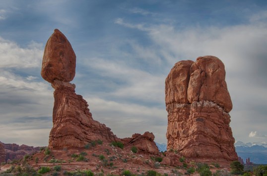
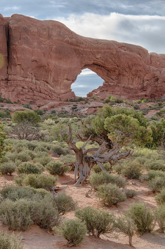
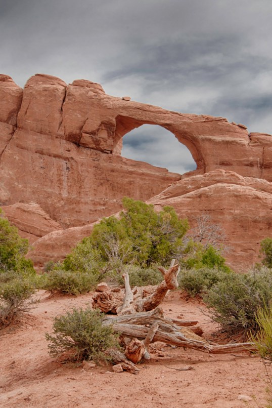
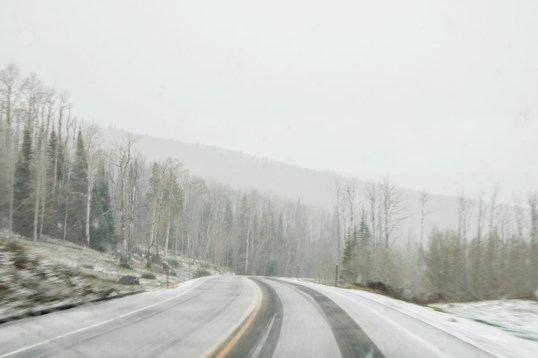
The next thing I know we’re in Boulder, Utah!  Looking at the map, I could see we had passed the dreaded section of road.  I had missed it!  I still don’t know how. I think I must have just “blacked out” when we got there, since I was quite worried about it.  My husband, the driver, says it was a bit scary.  We had hit it before the snow storm and I didn’t even know.

After writing this draft, I decided to google “The Hogback, Route 12, Utah” and found a couple of youtube videos of the drive.  I don’t think I missed it at all!  I think it just wasn’t nearly as scary as I had imagined it would be.  It’s a one-mile section between Escalante and Boulder. Try it for yourself and tell me what you think.

Zion National Park

We made the unfortunate decision to drive into Zion National Park on a Sunday. We left Bryce about 9:30am and arrived at the east entrance around 11am. Traffic was heavy. Looking at a map, we determined that many of the desirable viewpoints in the park were accessible only by the shuttle bus, so we decided to go directly to a parking area and get on a bus. The first obstacle we encountered was getting through the 1.1-mile tunnel near the east entrance. Because it was carved out of a mountain in the 1930s and is fairly narrow, a limited numbers of cars and campers are allowed to go through at a time.  That means that you must wait in a line near the entrance for a time to enter to be made available.  After that 20-30 minute wait, we were through the tunnel and on our way. But, the problem was that the traffic volume in the park was heavy and slow, and when we got to the Visitors Center, no parking was available. We kept moving, never finding parking even in the overflow lots. We never saw more than we could see from the car and a few busy pullouts along the way. We exited through the south entrance, turned around and re-entered, once again waiting to go through the tunnel on the other end and back to Bryce Canyon Lodge. One interesting tidbit.  The roads in the park are colored asphalt, the red color of the rocks in Utah. You can see that in the first photo.

ZNP 13

That said, Zion is a beautiful park.  Unlike Bryce Canyon, you are down among the cliffs.  They are close to you and you are constantly looking up at them.  We regret not being able to go on the shuttle to less accessible areas of the park, but my photos, many of them from the car, will tell you what’s there and how disappointed we were not to see more.  Enjoy.

This slideshow requires JavaScript.


Post Navigation

Our Cape Escape

renovation realities

Photography Life

PL provides various digital photography news, reviews, articles, tips, tutorials and guides to photographers of all levels

Perception

Photography. Life.

cookiecrumbstoliveby

Life through the eyes of "cookie"

The Legion of Door Whores

...for those who appreciate doors...

Ray Ferrer - Emotion on Canvas

** OFFICIAL Site of Artist Ray Ferrer **

Belle Grove Plantation Bed and Breakfast

Birthplace of James Madison and Southern Plantation

Leaf And Twig

Where observation and imagination meet nature in poetry.

Photography Improvement

Site Transferred from WordPress.com

Firnew Farm Artist's Circle

We meet weekly, and host: Review & Critique of New Works. Our Annual Spring Show is in May and our Annual Fall Show is September - October. Contact: Trish Crowe 540 948 3079

John Berry Photography

Portrait, Sports, Landscape Photographer in Central Virginia

CJ's Workshops

FILM INSPIRES!