Patricia Temples Photography

MAKE IT AN ADVENTURE! All rights reserved.

Archive for the category “TRAVELS”

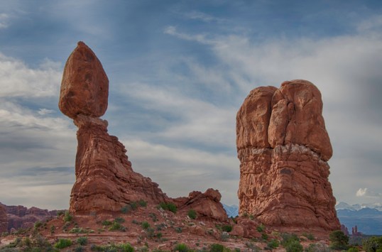
My Iceland Adventure, Part 2

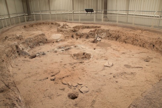
We spent three days in the area of Lake Myvatn which was created by a large lava eruption 2300 years ago.  On the east side of the lake we visited the Namafjall geothermal field, also known as Hverir.  This was the part of the trip that I found most interesting. The boiling mud pots, the colors of the earth, the steam vents through rock-covered boreholes were fascinating and new to me.  There is a lot of hot steam there, so areas are roped off, but there were plenty of places to photograph activity and to walk for good views.  There is a hiking trail into the mountain, which I used for a few higher shots, but the steepness and the rockiness of the terrain discouraged me from following the trail all the way over the mountain.

Mtn view 1

Fumaroles 1Fumaroles 2Larger view 1Larger view 2

TerrainBlue and tan earth 2Blue and tan earth 1

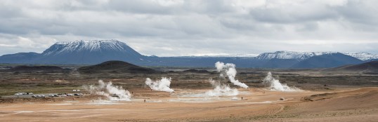
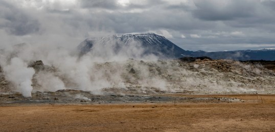
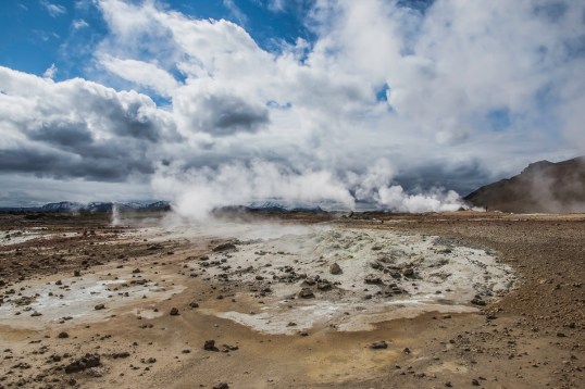
The mud pots are formed in geothermal area where there is little water.  The water that is available rises to the surface of the soil which is rich in volcanic ash, clay and fine particulates.  The blue color of the water is probably due to silica, and the surrounding tan color of the rock is a wonderful color contrast.

Mudpots 1

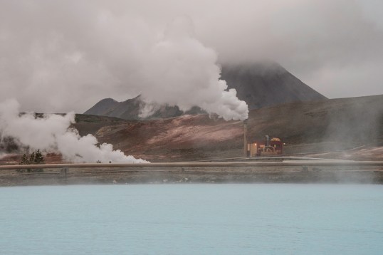
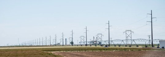
This terrain gave us the opportunity to learn about the geothermal energy of Iceland, and one of our outings included a trip to see the fifth largest power plant in the country, Krafla.  The five major geothermal power plants in Iceland produce about 26% of the nation’s electricity.  Geothermal heating meets the heating and hot water requirements of 87% of the buildings in Iceland.  Apart from geothermal energy, 73% of the their electricity is generated by hydro power, and .1% from fossil fuels.  The goal of Iceland is to completely eliminate fossil fuels for power generation, and that will be accomplished in the near future.

Power plant 1Power plant 2Steam plant 2Steam plant

One way that geothermal hot water was demonstrated to me most clearly was with the hot tub at one of the cabins where we stayed.  Our photographer instructor was testing the water for use in a few hours and found it to be cold.  Having had a hot tub at my home, I knew he couldn’t get the temperature high enough for possibly a day by my method.  His solution was to empty the hot tub, refill it with water from underground, and voila, instant hot water!  No chemicals required because the water doesn’t sit in the hot tub for days or weeks as it does here.  In Reykjavik there are underground pipes that carry hot water for heating the streets and sidewalks in winter to melt the snow!

The next post will take us to the western parts of Iceland, a thirteen-hour drive from Myvatn to the area near Latrabarg, the west fjords.


My Iceland Adventure, Part I

I had the thrill of a lifetime going to Iceland for a thirteen day adventure.  The major focus of the trip was a Birding and Landscape Photography Tour.  We did so many different things and stayed in such a variety of places that I am having difficulty organizing the trip for this blog.  But, I am going to jump in, posting in several stages.

Today I am going to tell you about our first stop, Myvatn (Me-vah’-tin).  We spent three nights in this beautiful area, exploring along the river Laxa, Lake Myvatn, and at the geothermal areas near Krafla.  The lake is known for its abundance of birds, and thirteen species of ducks nest there.  Many of them are migratory.  The harlequin duck is the duck everyone wanted to see and photograph, and they didn’t disappoint us.  They played on the bank of the river and swam in the bubbles of a small waterfall.
Harlequin ducks

Harlequin Duck

The phalarope is the first bird I photographed in Iceland, and probably the bird I saw the most in every location.  Many other birds were on the river and at Lake Myvatn.

Phalarope

Phalarope

In the photos above, clockwise from top left, are Tufted Ducks, Long-tailed Ducks, a Merganser, a Barrow’s Goldeneye, and a Horned Grebe.

But, of course, I am a landscape photographer, and I had the best opportunities on this trip for beautiful and unusual landscapes.  At the river, snow-capped mountains were the backdrop for beautiful farm buildings.

Lake Myvatn was a small lake that we could walk around in about 1.5 hours at a leisurely pace while stopping to photograph.  Of course, we met sheep along the way.

Lake scene 1Lake scene 2

Read more…

Wind Turbines

The first time I saw wind turbines was in 1992. While driving from Claremont CA to Palm Springs my friend and I happened upon a Wind Farm with hundreds of turbines. The land was down below the level of the road, in a valley. We bravely drove down among the turbines and it was magical. Today I believe there are guided tours in this same area so people can see what we saw 24 years ago up close and personal.

The next time I saw wind turbines it was from the air, Sept 2015 on a flight in a small plane over West Virginia. This time I got photos. Again, it was magical.

West VA WT.jpg

In May of this year my husband and I drove across the United States to visit some of the western national parks. When we were in Kansas and then Colorado, and later in New Mexico and Texas, we saw wind turbines.  I was excited.  I took a lot of photos from the car, repetitive and full of window glare, but I wanted to capture them all.  I think they look like sculptures! In the photo below you can see a crop-duster who was flying among the turbines.

With a plane
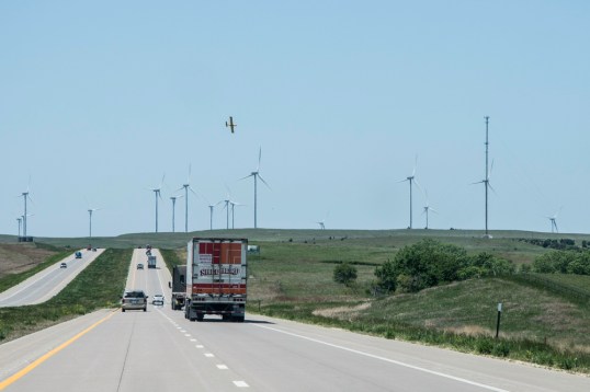
Last September when I posted a photo of the West Virginia ridge full of wind turbines, I got several comments about them, some pro, some con.  So today as I write this, I want to present some facts, some interesting, and some enlightening, at least to me.

My initial thoughts about wind turbines are that they are a beautiful and safe alternative to fossil fuels for energy.  When we drove through Kentucky, we saw in the distance a huge energy installation which included 3 nuclear reactors and 4-5 smoke stacks billowing smoke.  It was ugly and scary to me.  When I saw the wind turbines, it was a pleasant and peaceful sight.  So, I decided to do a little research on them.

WT 2

There are 48,800 utility-scale turbines (larger than 100 kilowatts for significant power generation) in 40 states and Puerto Rico.  The amount of energy generated in a year is the equivalent of energy used in 20 million homes. There are 88,000 wind-related jobs across the US.

WT 1The steel tower is over 300 feet tall,and the blades are 116 feet long.  The optimum wind speed for rotating the blades is 25-35 mph, creating a rotation of 14 rpm and a speed of 105 mph at the tip of the blade.  The blades rotate automatically into the face of the wind, and the pitch of the blades also changes as needed to optimize the capture of the wind energy.

The majority of wind farms are on private land, which is leased by the developer for the expected life span of the turbines of 20-30 years.  The current estimate of potential energy from wind farms is 10 times the energy consumption for the United States.

Now, to the concerns.  One friend mentioned that many birds get killed flying into the turbines.  Yes, 214,000 – 368,000 is the estimate. That’s too bad, isn’t it?  Estimates about bird deaths from other “obstacles” are:  cell and radio towers – 6-8 million;  windows on buildings – 1 billion;  cats – 1.4 – 3.7 billion.  Birds don’t have it easy.

WT 4

I read online that people are worried about having wind turbines near where they live because of the electrical charges in the air. One fellow said that his cell phone charges automatically without being plugged in! Out west the wind farms are in open areas, away from towns and cities, and to me that is the ideal location. There are often animals grazing under them, or crops growing among them. The land is still useful, there is no run-off of chemicals or toxic materials.  The electricity that is generated is of course “captured” and sent via power lines to where it is needed.  I have a new respect for power lines after my trip out west because they are the lifeline of the people there. Many, many miles can be traveled without seeing civilization, but you will see power lines making sure the next community has power.

WT 6 transmission lines

Finding ways to satisfy our ever-growing need for energy that is safe, clean and efficient is a worthy endeavor.  I vote for wind turbines.

Mesa Verde National Park, Colorado

We left the Mighty Five Parks in Utah, heading out for our return trip to Virginia. We took the southern route back, and there were several things we wanted to see along the way.  But, at the beginning of our trip, soon after we entered Colorado, we noticed another National Park not far from our route. So, we stopped in the town of Cortez to inquire at the Visitors Center about Mesa Verde. On the map, it is a relatively small park, especially compared to the huge Canyonlands Park we had just left. When I said that to the volunteer, she raised her eyebrows at me and said, “Well, to see even the best part of the park will take you four hours.”  Wow. She was right. We spent just about that much time in this park and could have spent more.

Mancos Valley
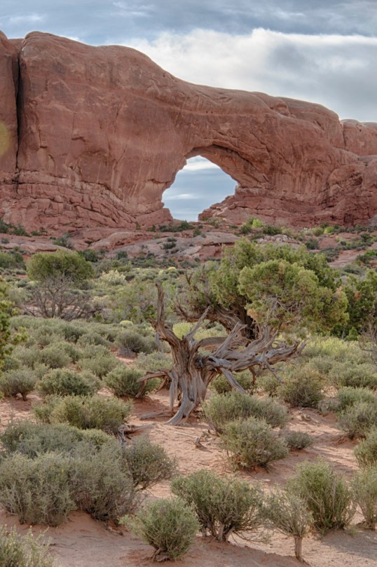
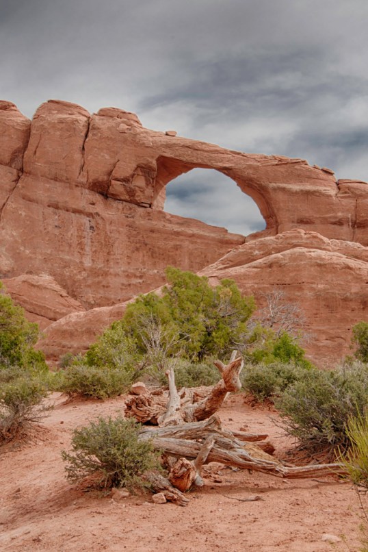
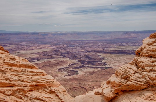
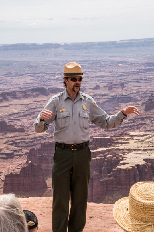
Because this is such a fascinating park, I am going to give you more facts, all lifted from the official brochure you receive at the visitors center.

Mesa Verde is Spanish for “Green Table.”  Ancestral Pueblo people settled in this area in A.D. 500.  They farmed, hunted wild animals and gathered edible plants.  They also made tools from stone, wood, and bone, and built pit houses for homes.  Pit houses were often clustered as small villages on the mesa tops. In the second photo below, you can see that they designed a system to keep their fires burning inside the pit.  Placing a stone in front of the opening below created a draft to pull air through and out a hole on the surface above.

Pithouses 1

Pithouses 2

In about A.D. 750, the Pueblos began building houses above ground using poles and mud.  By A.D. 1000 their skills had advanced to stone masonry.  Walls of thick stone often rose two to three stories high and were joined as units of 50 rooms or more.  Some of these homes were built in cliff alcoves that had once served their ancestors as sheltered areas.  The cliff dwellings are what made Mesa Verde famous.

Cliffdwellings 5A

Cliffdwellings 5B

Cliffdwellings 5

Most of the cliff dwellings were built from the late 1190s to late 1270s.  They range from one-room houses to community centers of about 150 rooms.  Builders fit the structure into the available space.  Notice the gorgeous stone around the cliff dwellings.  It’s a part of the beauty of the space, much as our land accentuates our property.

This slideshow requires JavaScript.

As we looked with binoculars across the canyon to the cliffs, we wondered how the Pueblos moved from one house to another, or from their home on the cliff to their gardens above.  It was a hard life.  They lived in the cliff dwellings for fewer than 100 years, and by 1300 Mesa Verde was deserted.  They joined other Ancestral Pueblo who moved south into what is now New Mexico and Arizona.

Local ranchers first reported the cliff dwellings in the 1880s.  Archaeologists have studied, excavated, analyzed and restored pit houses and cliff dwellings.  The history reveals people adept at building, and skillful at making a living on difficult land.   The evolution of their skills is evident in the various structures seen in the park.

Cliffdweller statue


Arches National Park

I’ve saved this Utah Park for last, even though it wasn’t the last of the Mighty Five we visited, but because this is a Park that many people know and recognize. We wisely determined that we should go to this park on Thursday instead of Friday after our experience at Zion. We entered this park at 7:30am, which was really too late for a sunrise photographer, but the light was still great, and the crowds were still asleep. It was a beautiful time to be there. My images don’t have the wow you have seen from other photographers, but I’m happy with them nevertheless.

ANP !ANP 2ANP 3

ANP 4

Petrified dunes

ANP 5ANP 6ANP 7-2ANP 8ANP 9ANP 10ANP 11

Canyonlands National Park

Canyonlands National Park is Utah’s largest park.  It is divided into four districts, but we only saw one, Island in the Sky.  That is the northernmost section, and it is a broad mesa bordered by the Green River on the west and the Colorado River on the east.  These two photos are from the Green River Overlook.

CLNP 1CLNP 2

There is a White Rim in the canyons below the overlooks, which is sandstone. A ranger talk that we heard indicated that when this area was under water, sand was deposited along the rim and as the water receded, essentially a beach was left behind.  If you look closely in the photo below, you can see a car approaching the whitest area in the foreground.  Special permits allow cars to go into the canyon for exploration or camping.  The day before we were going into the park, a shopowner showed us a special weather alert.  The White Rim Road was going to be closed the next day because of the expectation of 3 feet of water in the area!  We watched the weather forecast that night, but no rain was predicted.  I inquired of a hiker whom I heard talking at breakfast.  He was going into that area, and the water expectation was because of snow melt in the mountains.  It was going to be 84 degrees that day.  As you can see, the car was traveling in a totally dry area.  Some bikers also went by on this path near the rim as I watched.

CLNP 5

We heard a wonderful ranger talk about the geology of the park. It’s easy to see why this is called Canyonlands.

CLNP 10


Ranger 1Ranger 2

I walked out to Mesa Arch, which gives you a wonderful framed view of the La Sal Mountains in the distance.  I also saw a variety of desert plants on the short hike to this arch.  The arch was busy with photographers, both amateur and professional. As we jockeyed for position, one woman fell head first down a short, but steep cliff not far away.  I think she had a few bruises, mostly to her ego.  That could have been me in a heartbeat.

CLNP 13

Post Navigation

Our Cape Escape

renovation realities

Photography Life

PL provides various digital photography news, reviews, articles, tips, tutorials and guides to photographers of all levels

Perception

Photography. Life.

cookiecrumbstoliveby

Life through the eyes of "cookie"

The Legion of Door Whores

...for those who appreciate doors...

Ray Ferrer - Emotion on Canvas

** OFFICIAL Site of Artist Ray Ferrer **

Belle Grove Plantation Bed and Breakfast

Birthplace of James Madison and Southern Plantation

Leaf And Twig

Where observation and imagination meet nature in poetry.

Photography Improvement

Site Transferred from WordPress.com

Firnew Farm Artist's Circle

We meet weekly, and host: Review & Critique of New Works. Our Annual Spring Show is in May and our Annual Fall Show is September - October. Contact: Trish Crowe 540 948 3079

John Berry Photography

Portrait, Sports, Landscape Photographer in Central Virginia

CJ's Workshops

FILM INSPIRES!